Cambodia’s Landscape in Wet Season vs Dry Season: What Changes and Why It Matters
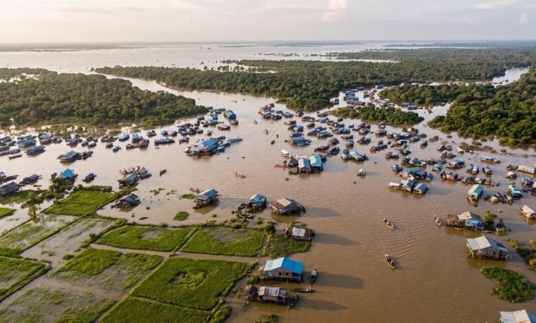
If you visit Cambodia in March, you might drive past dry, cracked rice fields and see a lake that looks modest in size. If you visit the same place in September, those fields may be underwater, and that lake may have grown so large that entire forests are submerged.
Cambodia’s landscape does not just change with the seasons. It transforms.
Understanding this transformation helps travelers see Cambodia more clearly — not just as a place with a rainy season and a dry season, but as a country whose geography is rebuilt by water every year. This article explains what happens to Cambodia’s land, rivers, lakes, and farms as the monsoon cycles through its wet and dry phases.
Why Cambodia Has Two Seasons, Not Four
Cambodia’s climate is driven by monsoon winds, which create two main seasons rather than the four seasons familiar to travelers from North America or Europe.
From roughly May to October or November, the southwest monsoon brings moist air from the Indian Ocean. This is the wet season. About 85–90% of Cambodia’s annual rainfall falls during these months.
From roughly November to April, the northeast monsoon brings drier, cooler air. This is the dry season. February is typically the driest month, while April is the hottest — temperatures can reach 40°C (104°F).
The national average annual rainfall is about 1,836 mm (1991–2020 climatology), but this varies widely by region. The coast and mountains receive far more rain than the central plains.
What the Wet Season Does to Cambodia’s Landscape
When the southwest monsoon arrives, Cambodia’s geography changes in ways that are visible from space.
The Tonle Sap: A Lake That Grows Five Times Larger
The Tonle Sap is Southeast Asia’s largest freshwater lake, and it behaves unlike almost any other lake in the world.
During the dry season, the lake is relatively compact — roughly 2,500 to 3,000 square kilometers in surface area, with water about 1.5 meters deep.
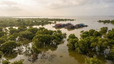
Then the Mekong River rises. Water from the Mekong pushes up the Tonle Sap River and into the lake, reversing the river’s normal flow direction. The lake swells to 10,000 to 13,000 square kilometers — five to six times its dry season size — with water depths reaching 9 to 10 meters.
This annual event is called the flood pulse. It is one of the most important geographic phenomena in Southeast Asia.
The flooded forests around the lake — trees that can survive months underwater — become breeding grounds for fish. The Tonle Sap fishery yields approximately 230,000 tons of fish annually, and about half of Cambodia’s population benefits from the lake’s productivity either directly or indirectly.
Rivers That Change Direction
The Tonle Sap River is one of the few rivers in the world that reverses its flow direction annually.
During the wet season, water flows from the Mekong into the Tonle Sap Lake. During the dry season, the flow reverses — water drains from the lake back toward the Mekong.
This reversal is not a slow, gradual process. The change typically occurs in late May or early June, and again in September or October.
For travelers, this means the river you see flowing one direction in January may be flowing the opposite direction in July.
Rice Paddies That Become Inland Seas
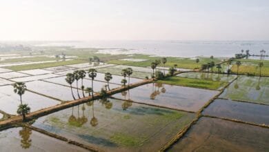
Cambodia’s central plains are the country’s rice bowl. During the wet season, these low-lying areas flood extensively.
The wet season rice crop accounts for about 70% of Cambodia’s annual rice output. Farmers plant in May or June and harvest from August to November, depending on the variety and location.
As the floodwaters spread across the plains, the landscape looks less like farmland and more like a vast shallow sea. Villages built on stilts or floating platforms become the only dry land for miles.
What the Dry Season Does to Cambodia’s Landscape
When the northeast monsoon arrives, the water retreats — and the land reveals itself again.
Shrinking Water, Expanding Land
The Tonle Sap shrinks back to its dry season size. The flooded forests emerge. The Tonle Sap River slows and eventually reverses direction.
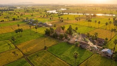
The floodplains that were underwater for months become dry land. Farmers plant a second, smaller rice crop — the dry season crop, which accounts for about 30% of annual output and depends heavily on irrigation.
The receding water deposits nutrient-rich sediment on the floodplains. This natural fertilization is one reason the Tonle Sap region is so agriculturally productive.
The Color of the Countryside Changes
Satellite imagery shows a clear seasonal pattern in Cambodia’s vegetation.
During the wet season, the country is deep green. Rice paddies are flooded and vibrant. Deciduous forests are full of leaves.
During the dry season, the landscape changes color. Deciduous forests turn from green to yellow and brown as they lose their leaves. Evergreen forests — mostly in the southwest and highland areas — remain green year-round.
The overall effect is a country that looks completely different depending on when you see it.
Life Adapts to Less Water
As water becomes scarcer, daily life shifts. Fishing communities move to different areas. Farmers switch from wet season rice to irrigated dry season crops or other vegetables. Water storage and irrigation systems become critical.
The dry season is also Cambodia’s peak tourist season. Clear skies, lower humidity (though temperatures can still be high), and dry roads make travel easier — but the landscape is at its least lush.
How the Landscape Changes in Different Regions
Cambodia’s seasonal changes are not uniform across the country. Geography — mountains, distance from the coast, elevation — shapes how each region experiences the wet and dry seasons.
The Central Plains
The central plains, including the Tonle Sap basin and the Mekong floodplains, experience the most dramatic seasonal changes.
This is where the flood pulse is most visible. Rice paddies that are dry and cracked in March become flooded fields in September. The Tonle Sap Lake grows and shrinks by thousands of square kilometers.
The plains receive moderate rainfall — around 1,300 to 1,500 mm annually — which is enough to support wet season rice but not enough to make the landscape permanently green without irrigation.
The Cardamom Mountains and Coastal Areas
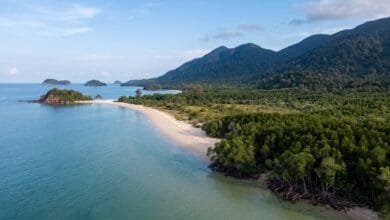
The Cardamom Mountains and the southwestern coast receive far more rain than the rest of the country — 3,000 to 5,000 mm annually in some areas.
This region stays green year-round. Evergreen forests dominate. Rivers and waterfalls in the Cardamom Mountains flow strongly during the wet season and continue to flow during the dry season, fed by the high rainfall.
The coast — including Kampot, Kep, and Sihanoukville — has a slightly different pattern. The wet season brings heavy rain from May to October, but the dry season is cooler and more comfortable than in the interior.
The Eastern Highlands
The eastern highlands (Ratanakiri, Mondulkiri, and parts of Kratie and Stung Treng) receive substantial rainfall — often more than the central plains — but the landscape is different.
This region is higher in elevation, with forests and plateaus rather than floodplains. The wet season brings mist, cooler temperatures, and dramatic waterfalls. The dry season is drier and clearer, but the higher elevation keeps temperatures more moderate than the lowlands.
Travelers visiting Mondulkiri in the wet season often encounter misty hills and green landscapes. In the dry season, the same area can look browner and dustier.
What Travelers Notice Between Seasons
If you visit Cambodia in both seasons, the differences are impossible to miss.
In the wet season: The country is green and lush. Rice paddies are flooded. The Tonle Sap is enormous, and flooded forests are visible around its edges. Rivers run high. Afternoon downpours are common — usually heavy but short. Roads in rural areas can become muddy or flooded. The temples at Angkor reflect in full moats and reservoirs.
In the dry season: The country is drier and browner, though still warm. The Tonle Sap is smaller, and the flooded forests have emerged. Rice paddies are either harvested or being prepared for the next crop. Skies are generally clearer. Roads are easier to travel. December and January are the coolest months.
Both seasons have their own character. Neither is “better” — they are simply different versions of the same country.
Why This Seasonal Geography Matters
Cambodia’s seasonal landscape transformation is not just a curiosity. It shapes the country’s economy, food supply, and daily life.
The Tonle Sap flood pulse supports one of the world’s most productive freshwater fisheries, providing protein and income for millions of people. The wet season rice crop feeds the nation and supports exports. The dry season crop, though smaller, provides additional income and food security.
Understanding this cycle helps travelers see Cambodia not as a static destination but as a country defined by water — its presence, its absence, and its annual return.
When you understand the seasons, you understand why Cambodian communities have developed particular ways of living: stilt houses, floating villages, fishing practices timed to the flood pulse, and farming calendars built around the monsoon.
Frequently Asked Questions
When is the wet season in Cambodia?
The wet season runs roughly from May to October or November, driven by the southwest monsoon. About 85–90% of Cambodia’s annual rainfall falls during this period.
When is the dry season in Cambodia?
The dry season runs roughly from November to April, driven by the northeast monsoon. February is typically the driest month, and April is the hottest.
Does the Tonle Sap really grow five times larger?
Why does the Tonle Sap River change direction?
Which parts of Cambodia stay green year-round?
What does Cambodia look like in the dry season?
The dry season is browner and drier. Deciduous forests lose their leaves. Rice paddies are harvested or fallow. The Tonle Sap shrinks. Skies are generally clearer.
What does Cambodia look like in the wet season?
The wet season is green and lush. Rice paddies are flooded. The Tonle Sap expands dramatically. Flooded forests are visible around the lake. Afternoon rains are frequent.
Is it worth visiting Cambodia in the wet season?
Many travelers visit in the wet season and find it rewarding. The landscape is at its most dramatic, the temples reflect in full reservoirs, and there are fewer tourists. Rain is usually heavy but short.
Conclusion
Cambodia’s landscape is not a fixed backdrop. It is a living system that changes dramatically between the wet and dry seasons.
The same road can be a dry rice paddy in March and a flooded field in September. The same lake can be a modest body of water in January and an inland sea in August. The same forest can be green and dense in one season and bare and brown in another.
Understanding this seasonal geography helps travelers see Cambodia more clearly. It explains why water is so central to Cambodian life, why farming and fishing follow particular rhythms, and why the country looks so different depending on when you visit.
Whether you come during the wet season or the dry season, you are seeing one version of a country that is always in motion — shaped by monsoon winds, river flows, and the annual return of water to the land.